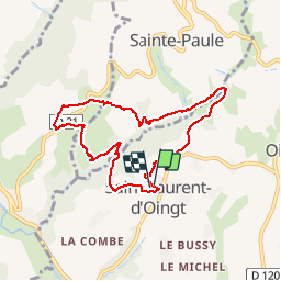
69620_stlo+ternand+stepaule-160417-MtJoli+Ronzières+StePaule+Vervuis+Polluis

adye
Gebruiker

Lengte
7,7 km

Max. hoogte
433 m

Positief hoogteverschil
206 m
Km-Effort
10,4 km

Min. hoogte
320 m

Negatief hoogteverschil
203 m
Boucle
Ja
Datum van aanmaak :
2016-04-17 00:00:00.0
Laatste wijziging :
2016-04-17 00:00:00.0
1h30
Moeilijkheid : Medium

Gratisgps-wandelapplicatie
 SityTrail
IGN / Geografische instituten
SityTrail Plus
De wereld gaat voor u open
Over ons
Tocht Stappen van 7,7 km beschikbaar op Auvergne-Rhône-Alpes, Rhône, Val d'Oingt. Deze tocht wordt voorgesteld door adye.
Beschrijving
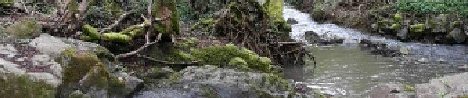
Mont Joli, ruisseau du Vervuis (à traverser s/ pont de fortune), Les Brotteaux (Ternand), Sainte-Paule, Vervuis, Polluis.
Foto's


Plaatsbepaling
Land:
France
Regio :
Auvergne-Rhône-Alpes
Departement/Provincie :
Rhône
Gemeente :
Val d'Oingt
Locatie:
Saint-Laurent-d'Oingt
Vertrek:(Dec)
Vertrek:(UTM)
621064 ; 5089134 (31T) N.
Opmerkingen